![]()
| Site photos | 
2000 Blowup |
|||
| To see:
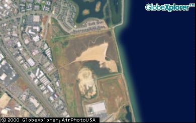
An plane's view of the site around 1995, click plane's view of Canalways to San Rafael Creek. Portion of uplands site in summer 1998, Uplands 1998. Another portion of uplands site in summer 1998 from pond area toward route 580, Uplands 1998 Toward 580. The 50" broken pond water discharge pipe that was flooding Bay salt water back into the Canalways site and that the City finally fixed around 1999, click Broken Pipe View of the pond and distant pump house after repairs were made to the 60" broken water discharge pipe around 1999 and the pump levels were being worked on, click Pond and Pump. Close up of the 1999 Pond and Pump shot mentioned above. A year 2000 aerial view of site, click Aerial of Canalways 2000.
|
History SRCanal Spoils Beneficial Reuse Site Flooding Mouse-SMHM Mixed Use Kerner Blvd Affordable ownership housing School Athletics Play fields ShorelinePark Traffic Pond Levee Environmental enhancement
|
|||